
GBNRTC Online Bicycle Map
The GBNRTC Online Bicycle Map lets you view different features of Erie and Niagara Counties' bicycle infrastructure, including:

Click on the image of the map above to open the GBNRTC Online Bicycle Map
Bike Shops
Bike Racks
Multi-Use Trails
Bike Lanes
New York State Route 5 & 517
GBNRTC Boundary
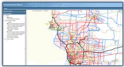
Transportation Improvement Program (TIP) Maps
The following maps and information are meant to provide you with basic information about FFY 2023-2027 projects in and around the Western New York/GBNRTC MPO Area.

Click on the image of the map above to open the GBNRTC Interactive TIP Projects Map
Transportation Data Management System

Click on the image above to open the Web-Based Transportation Data Management System (TDMS)
GBNRTC’s Transportation Data Management System (TDMS) is comprised of two types of basic traffic data conducted annually for our traffic data collection program. The program involves the systematic collection of traffic data at certain cycles utilizing automatic traffic recorders (ATR – 24 Hour Station Counts measuring traffic volumes over a 48 period) and manual turning movement counters (Jamar – counting vehicle and pedestrian movement at an intersection during the a 10 hour period) located on various roadways and intersections throughout Erie and Niagara Counties.
Web-Based Transportation Data Management System (TDMS)
*Clicking the above link will exit GBNRTC Website!
FOR MORE INFORMATION
Traffic Signal Management System (TSMS) Quick Reference Guide
If you need assistance with this application, contact TDMS@gbnrtc.org
If you have questions about Turning Movement Counts (TMCs), contact the TMC Coordinator
If you have questions about Traffic Counts/Automatic Traffic Recorders (ATRs), contact the Traffic Count Database System (TCDS) Coordinator
DISCLAIMER:
Traffic count data are provided as a public service by GBNRTC’s and member agencies. Traffic volumes are collected by manual and mechanical means and are hosted at an independent site. They represent typical volumes likely to be found at a location. Counts are reviewed for accuracy but are subject to inaccuracies inherent in the collection method and variability of traffic flows. Traffic data collected prior to and including 2012 were uploaded in bulk, and may be subject to data transfer and processing errors.
Please be aware that errors may still exist even though reasonable efforts were made to identify and correct any errors. > The data on this web site is posted for informational purposes only. GBNRTC assumes no responsibility or any liability whatsoever which may develop by users' review and use of this data. The data contained within this website is periodically updated. Users are responsible to be aware of any updates and incorporate the updated data as may be appropriate for their work.
NYSDOT Functional Class Viewer
The Functional Classification & National Highway System Viewer (FC/NHS Viewer) is a GIS web application for viewing the following:
Click on the image above to open the NYSDOT Functional Classification Viewer
NYSDOT Rural codes 01, 02, 04, 06, 07, 08 (excluding 09)
NYSDOT Urban codes 11, 12, 14, 16, 17, 18 (excluding 19)
NHS mainlines and intermodal connectors
This link will take you to the NYSDOT Functional Classification Viewer
NYS Traffic Data Viewer
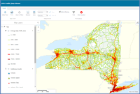
Click on the image above to open the NYS Traffic Data Viewer
The NYS Traffic Data Viewer is an interactive map that provides traffic data consisting of volume, speed, and vehicle classification.
NYSDOT Roadway Inventory System Viewer (RIS) Viewer
The Roadway Inventory System Viewer (RIS) Viewer is a GIS web application for displaying data contained in the Roadway Inventory System (RIS) database. At this time, the following data is available on the RIS Viewer:

Click on the image above to open the NYSDOT Roadway Inventory System (RIS) Viewer
Federal Aid Eligible System (All Public Roadways)
State Highway, Posted Speed Limits
State Highway, Annual Average Daily Traffic Volumes
Shapefile Roadway Inventory System is located on the NYS GIS Clearinghouse.